Candy’s Castle
Another Castle Rock?
Every so often I put mom to work digging up old photographs and writing on the back of them to tell us who the people are in the picture.
Often she doesn’t know, but she gets excited when she finds one with her Mama. This particular photo, she also found one of her mother AND her mother’s father, William S. Buckwalter.
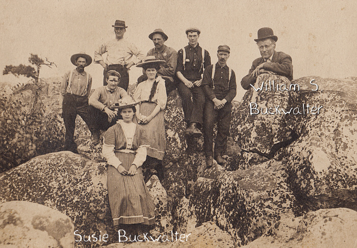
On the back, the caption reads: “Candy’s Castle Rock on Cacapon River”
Since I was married at a Castle Rock in Western Australia, I was curious where THIS Castle Rock was. (Picture of the rocks HERE)
The Cacapon River (local /k??ke?p?n/ k?-KAY-p?n; meaning Medicine Waters), located in the Appalachian Mountains of West Virginia’s Eastern Panhandle region, is an 81.0-mile-long (130.4 km) river known for its fishing, boating, wildlife, and scenery. As part of the Potomac River watershed, it is an American Heritage River.
There is a bit of a story about the rocks:
“CANDY’S CASTLE”
Named for James Caudy, pioneer and Indian fighter, who took refuge from the Indians on a mass of rocks overlooking Cacapon River during the French and Indian War (1754-1763). From his position on the Castle of Rocks, he defended himself by pushing the Indians, one by one with the butt of his rifle, over the precipice as they came single file along the narrow crevice of rocks. They fell 450-500 feet to the base along the edge of the Cacapon.